The project
The project is initially being funded by the Federal Ministry of Education and Research as part of the "Stadt-Land-Plus" funding program for a three-year research and development phase (01.02.2020 - 31.01.2023), which may be followed by a two-year implementation phase in the future. In the first project phase, €2.36 million will be made available for urban and regional development in the region.
Spatial Information System (RIS)
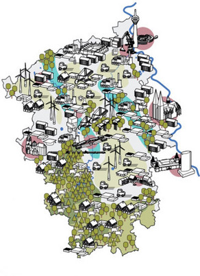
Project results and collected information are incorporated into a spatial information system (RIS). Against the background of possible inequalities in living conditions and the quality of services of general interest, the focus is on the regional distribution of residential, commercial and transportation areas. The project will also develop practical solutions to reduce land use competition between settlement areas and open spaces.
Presentation of the beta version of the spatial information system (RIS)
Project partners
The research project is being carried out by a network of science and practice consisting of TU Dortmund University (network coordination), RWTH Aachen University, infas - Institute for Applied Social Science GmbH, the city of Düren and the district of Euskirchen. The "Zukunftsagentur Rheinisches Revier" is also involved as an associated partner.


![[Translate to English:] [Translate to English:]](/storages/dazwischen/_processed_/f/2/csm_teaser-projektaufbau_846bff67ba.jpg)


